Freshkills Park

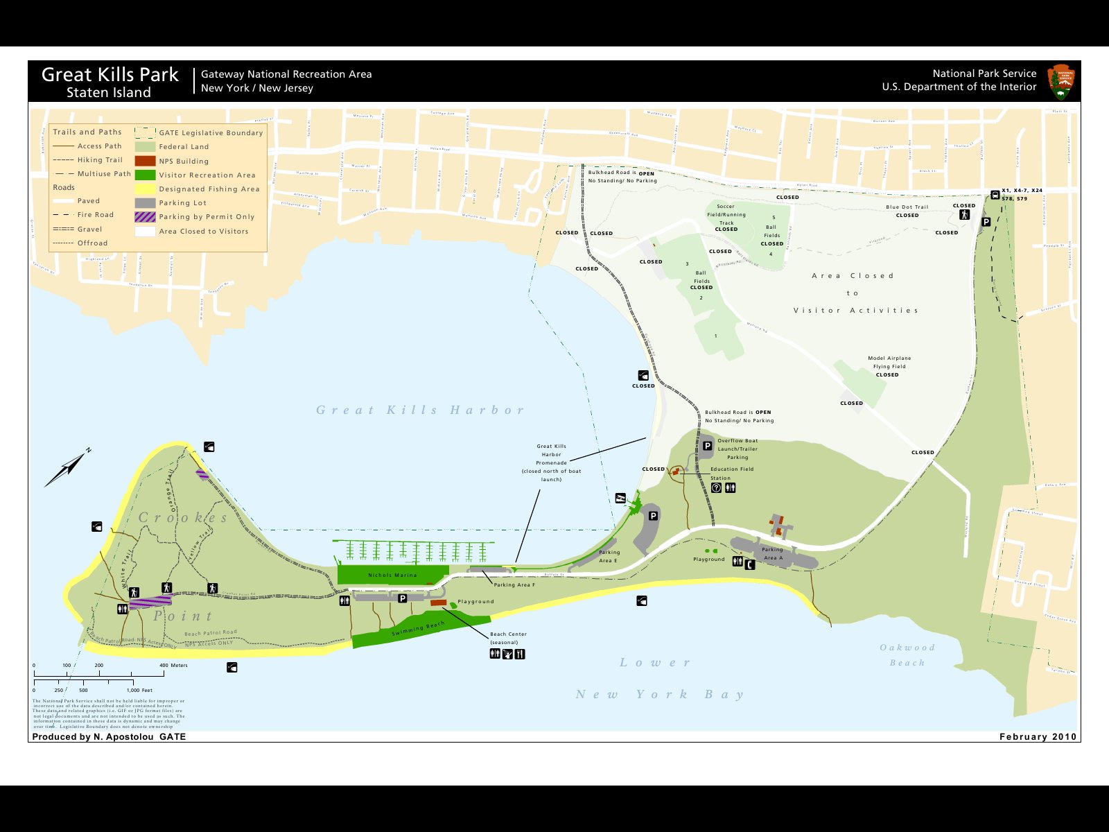
It’s not impossible, but making your way to Freshkills Park is a bit of a trial. The park is not officially open yet, so one either has to visit during a planned event or get a group together for a tour. Despite the challenge, a trip to this amazing changing landscape is definitely worth the trek out to Staten Island.

Freshkills was originally opened in 1948 as a landfill. It was meant to be open for only three years, but it stayed open until 2001. A design competition was then held and a plan to create Freshkills Park was chosen. The company that won was Field Operations, the same group that designed the High Line. Work officially began on the park in 2010 and they hope to have it finished by 2030.

DSC_0025
Smokestacks in the background of Freshkills

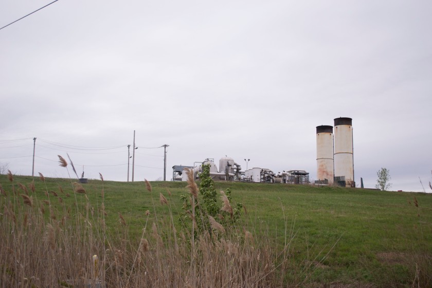
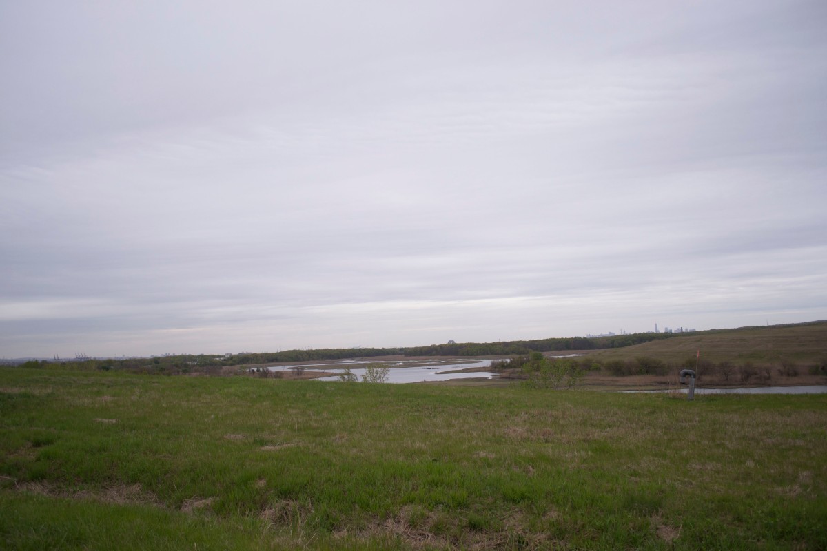
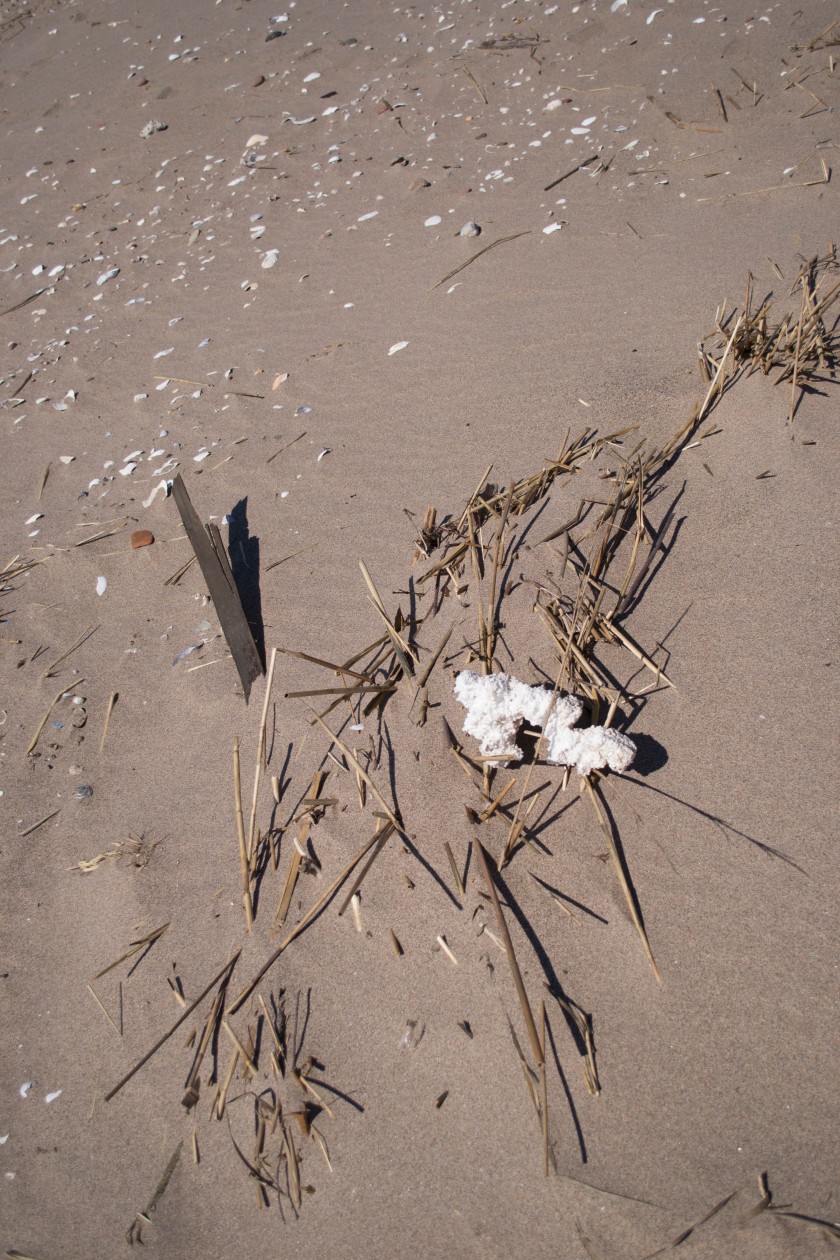
When I went on a tour of the park I was amazed that it used to be the world’s largest landfill. The rolling, grassy hills and the beautiful creek did not immediately scream trash mountain to me. Upon a closer look, I could see the signs of the past. Smoke stacks behind hills, garbage trucks, and gas well heads scattered throughout the landscape reminded me that the hill I was climbing was almost entirely made of trash. Between me and the trash was a soil barrier layer, a gas vent layer, an impermeable plastic liner, a drainage layer, at least two feet of barrier protection material, and at least six inches of planting soil. The engineers who designed this park had safety in mind when considering how to cover the trash. The drainage layer is to make sure that leachate (water that mixes with waste and toxic substances) would not leak into the kill (an old Dutch word for creek). The gas vent layer connects with the gas well heads and then the landfill gas (LFG, which consists of methane, carbon dioxide, water, and other organic matter) is then collected and stored. Since methane and CO2 are both greenhouse gasses, it is important that LFG is collected so they are not released into our already polluted atmosphere.

Freshkills, as well as reusing a damaged landscape and converting it into a natural area for the city to enjoy, also pays attention to how it can be environmentally sustainable. Currently the gas collected from the landfill is purified, sold to National Grid, and used to power many neighborhoods in Staten Island. In 2013 former New York City Mayor, Michael Bloomberg announced that Freshkills would be the site of the largest solar power installation in the city. This installation is expected to produce over 10 megawatts of power and make the city produce 50% more renewable energy. Wind turbines and geothermic heating and cooling systems might also be placed in Freshkills.

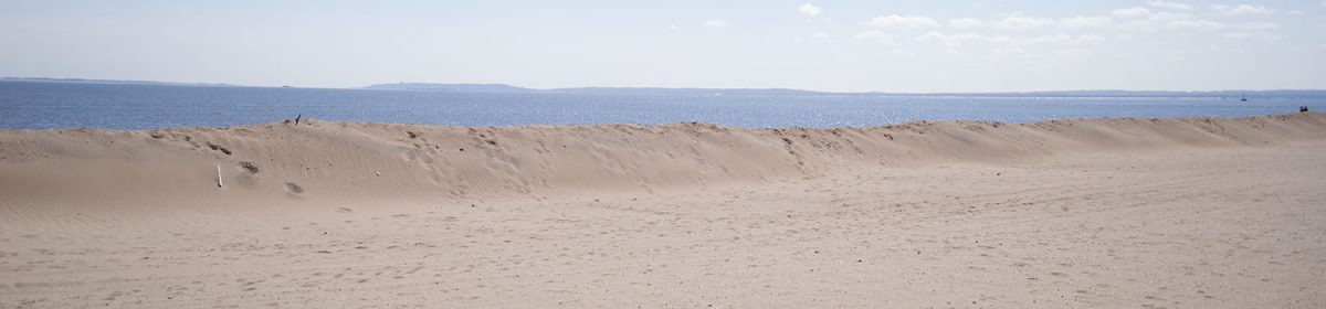
The reenergization of Freshkills also helps the city in other ways. The area was originally a low-lying salt marsh, but the landfill compacted everything and altered the landscape. The transformation of the landfill to a park has helped reestablish the marsh. The plan is to bring back native habitats and reduce non-native and invasive plants. Currently the park suffers from an infestation of non-native phragmites, a plant that looks like a tall grass and thrives near wetlands, but will take over any available lands. The park has used goats in the past to get rid of the invasive species, but the population of phragmites has come back. Anyway, the now reinvigorated marsh provides a vital service to Staten Island. During Hurricane Sandy, the hills of trash and waterways which were once used to float waste into the landfill, protected the neighborhoods of Travis, Bulls Head, New Springville, and Arden Heights from what could have been catastrophic flooding. Though they did still receive some of Sandy’s storm surge, they were saved from the worst of it.

DSC_0040
Freshkills Landscape

Freshkills Park is a symbol of our changing mentality toward the environment and a hopeful sign to end my journey through New York’s parks this semester. Though only two sections of the park are currently open for all year public use – Schmul Park and Owl Hollow Soccer Fields – Freshkills Park will one day become the second largest park in New York City and be sustainable. It was designed with protecting our environment in mind and promoting green energy. I believe that the conservation practices currently in place at the park in combination with the sustainable design will make Freshkills Park one of the most prepared parks in New York for the effects of climate change.


Helpful Links:

http://freshkillspark.org/

http://www.archdaily.com/339133/landfill-reclamation-fresh-kills-park-develops-as-a-natural-coastal-buffer-and-parkland-for-staten-island

http://artsbeat.blogs.nytimes.com/2012/12/17/staten-island-landfill-park-proves-savior-in-hurricane/?_r=0

https://dirt.asla.org/2012/12/18/freshkills-park-protected-staten-island-during-hurricane-sandy/

http://freshkillspark.org/the-park/chronology-of-the-freshkills-park-site

http://www1.nyc.gov/office-of-the-mayor/news/381-13/mayor-bloomberg-city-s-largest-solar-energy-installation-be-built-freshkills-park#/0


Retreat

As I have shown in my earlier science posts, sea level rise is one of the biggest challenges New York City will face due to climate change. The storm surge of Hurricane Sandy made it clear that the city was not equipped against floods caused by extreme weather events. In earlier posts two options were explained, a “soft” approach – beach nourishment – and a “hard” approach – barriers. In this post we will discuss retreat, the option left when nothing else will work.

Retreat is the act of moving away from the shoreline. Residents are encouraged to sell their land and then the government allows the land to return to its natural state. The option was discussed in Gornitz et al.’s 2002 paper Impacts of Climate Change on NYC Coasts. In Storm Surge, Sobel mentions a similar plan in the Netherlands. “Return to the River” forced residents, who were mostly farmers, to leave an area, which was then returned to a floodplain. A few negotiated to stay in the area, but the majority left.

After Hurricane Sandy, it became even clearer that retreat would be necessary. While Bloomberg said that retreat was not an option (Revkin 2013), Governor Cuomo signed off on the purchase of three neighborhoods in Staten Island, Oakwood Beach, Ocean Breeze, and Graham Beach, for retreat as part of the Hazard Mitigation Grant Program. These neighborhoods had almost all of the residents agreeing to sell their homes, with a few holdouts (Rush 2015a). During his State of the State address, Cuomo said, “There are some parcels that Mother Nature owns […] She may only visit once every few years, but she owns the parcel and when she comes to visit, she visits” (Homeland Security News Wire 2013). Many other neighborhoods along the east coast of the island, all of which were hit very hard by the storm surge of Hurricane Sandy, wanted to get in on the buyout, but a representative of Cuomo said the governor would not authorize the purchase of the entirety of the coast. The purchased neighborhoods have already begun to be demolished and reestablished as wetlands. The land would be planted with native grasses and retention pools would be built to capture the rainwater. The process cannot be completed until all residents leave. A large section of one neighborhood is currently owned by a developer who is holding out on selling the land, which poses a problem for the reestablishment (Rush 2015b).

foxbeach011_resize-650x465
A home in Oakwood Beach waiting to be demolished – Source Urban Omnibus

There are other options for homeowners who want to relocate. “Build It Back” is a program which offers to pay for repairs or elevation of homes hurt by Hurricane Sandy. An acquisition program run alongside “Build It Back” offers to purchase homes on their own instead of a neighborhood buyout. The difference between this type of purchase and a group buyout is that individual purchases do not get returned to nature, instead they are redeveloped and new structures are built. This is not as good of a plan as retreat. Most of the areas that become severely flooded during storms used to be wetlands and were backfilled to make room for buildings. More than half the people who died during Hurricane Sandy lived in areas that used to be wetlands (Rush 2015a). Rebuilding on these areas could increase the number of fatalities in the future.

Retreat, though the severest choice in the fight for the coast, is the safest option both for human life and wildlife. Beach nourishment and barriers both lead to erosion and damage the habitat of wildlife that lives in the area. They are also incredibly costly and though barriers can reduce flood levels, they still leave residents in danger from the water that makes it over the seawall. Retreat puts no one in danger and returns the land to its natural state. Wetlands will protect the coast from sea level rise and storm surges. They will serve as a buffer for nearby residents from the elements and also vice versa by stopping runoff from going directly into the ocean.

In the next, and final, science blog we will take a look at some of the invasive species I got to know during my visits to New York parks.


Bibliography:

Gornitz, V., S. Couch, and E. K. Hartig. 2002. Impact of sea level rise in the New York City metropolitan area. Global and Planetary Changes 32: 61-88.

Homeland Security News Wire. 2013. NY to buy, demolish beachfront homes, make way for storm buffers. Homeland Security News Wire. http://www.homelandsecuritynewswire.com/dr20130207-ny-to-buy-demolish-beachfront-homes-make-way-for-storm-buffers

Revkin, A. C. 2013. Can Cities Adjust to a Retreating Coastline. The New York Times. http://dotearth.blogs.nytimes.com/2013/08/22/can-cities-adjust-to-a-retreating-coastline/?_r=0

Rush, E. 2015a. As the Seas Rise: Managing retreat along New York City’s Coasts. New Republic. https://newrepublic.com/article/123182/managing-retreat-along-new-york-citys-coasts

Rush, E. 2015b. Leaving the Sea: Staten Islanders Experiment with Managed Retreat. The Architectural League’s Urban Omnibus The Culture of Citymaking. http://urbanomnibus.net/2015/02/leaving-the-sea-staten-islanders-experiment-with-managed-retreat/

Sobel, A. 2014. Storm Surge: Hurricane Sandy, Our Changing Climate, and Extreme Weather of the Past and Future. HarperCollins. New York, New York, USA.

Vinnitskaya, I. 2013. NY State’s Governor Cuomo’s Solution for Ravaged Homes in NYC’s Coastal Region. Arch Daily. http://www.archdaily.com/331154/governor-cuomos-solution-for-ravaged-homes-in-nycs-coastal-region/

Image: http://urbanomnibus.net/redux/wp-content/uploads/2015/02/FoxBeach011_resize-650×465.jpg


Great Kills Park

My trip to Great Kills Park, part of the Staten Island Unit of Gateway National Recreation Area accidentally occurred too early for two different reasons. The first reason is that I went in late March, only a week before the ranger station opens up for the summer season, though I didn’t realize it at the time. The second reason takes a bit more explaining, so keep reading.

After a long bus ride from Manhattan, I arrived at Great Kills Park – two stops after the one I was supposed to get off on. Siri has never been my friend and the location I thought was supposed to be the park entrance was actually just a fenced off section of the park. I walked along the side of the road to get back to where the gate is and once again took in the sight I’ve become so used to: trash everywhere and lots of vines.

When I finally made it to the gate I was surprised to realize how far of a walk it was to get to the main section of the park. The sidewalk stretched on forever and there wasn’t much to see. The parklands on either side of the road were fenced off. I saw a sign saying that an environmental cleanup operation was going on and that entrance was prohibited. Other signs said that there were hazardous materials in these spaces. I kept walking.

The path was surprisingly busy, despite the chill. Lots of people were running or riding their bikes. Some walked with family, others chatted on their cell phones. All were out to enjoy the park.

Eventually I reached the beach, and the closed visitors center and parking lots. The beach seemed nice, though lifeguards were not posted at the time (they’ll start working after Memorial Day). I’m not much of a beach person, so I kept walking. I passed by the busy marina and walked all the way out to Crookes Point. In this area of the park I was finally able to find hiking trails, though they were very short and not cleared very well. They felt like afterthoughts to the general purpose of the park. Finally, I sat on the edge of the water, on a rocky ledge, watching a group of men fish and some seagulls fighting.

All in all, I have to say that this is not my kind of park. I prefer parks with great views and lots of hiking trails. Great Kills is meant for more recreationally minded people, what with the beach and marina. My assessment of the park was furthered when I was able to get ahold of a map. The park contains soccer fields, four ball fields, a model airplane flying field, and a few more trails in that mysterious closed off section of the park.

That 265-acre mystery section was once a city landfill. Robert Moses (the same Moses who built the Jamaica Bay Ponds) wanted to strengthen that section of Staten Island marshland so that it could be used for recreational purposes. Household and industrial trash was dumped there to compact the land and fill it. In 2005 during a helicopter sweep of the area, the New York Police found 80 hot spots of radiation, which were 200 times the background levels expected in such an area. That section of the park was then closed down to be surveyed. Though Hurricane Sandy delayed the survey process, eventually the National Parks Service discovered 1,200 locations with elevated levels of radiation. Thirty-five of the spots were excavated and the rest still need to be investigated.

It doesn’t end there though. During the survey, the NPS realized that not only was the radiation even more prevalent than they first suspected, they also found out that the waste material dumped in the land, as well as having radioactive materials, contained chemical contaminants. This has led to another, separate study of the land that started in 2015, which will take approximately five years to finish.

DSC_0193
Trash on Crookes Point in Great Kills Park

It’s hard for me to make an assessment of how well Great Kills can stand up against climate change with so much of the park blocked off. It was difficult to get a feel for how much land invasive species had taken over. From what I could tell, the beach seemed healthy – if a bit full of trash – and there were barriers in place to prevent erosion. On park message boards I saw signs for a Littoral Society clean up event from last October. I visited Great Kills four years too early to really understand the park, but hopefully I’ll get the chance to visit again in the future.


Helpful Links:

https://www.nps.gov/gate/learn/management/greatkillscleanup.htm

https://www.nps.gov/gate/learn/management/environmental-investigations.htm

http://www.silive.com/news/index.ssf/2015/03/great_kills_park_hazardous_was.html

http://www.silive.com/news/index.ssf/2013/09/nps_official_radiation_amount.html

http://www.silive.com/opinion/index.ssf/2015/04/great_kills_park_contamination.html

https://upload.wikimedia.org/wikipedia/commons/2/2b/NPS_Great_Kills_Park_Map.jpg


Fort Wadsworth

After a train, subway, ferry, and ultimately bus, I arrived at Fort Wadsworth, part of the Gateway National Recreation Area. Gateway is a collection of three different sites: Sandy Hook, New Jersey; Jamaica Bay; Staten Island, each with multiple park locations. Fort Wadsworth is part of the Staten Island unit and I was very excited to explore a part of New York I hadn’t been to before.

When I arrived at the park, I was disappointed to see that the visitor’s center was closed. I located a map though and attempted to make my way through the park. Crumbling structures from the old military days line the road leading to the overlook. I wanted to take a closer look at the abandoned buildings, but there were signs saying, “Area Closed”. I continued down the path and reached the overlook where you can see Fort Tompkins, the water, and Narrows Bridge, which is directly over the park. It was here where I was able to get a better look at the landscape. This military site is situated on a tall bluff, surrounded by woods, with a small beach. It looked like an interesting place to explore.

DSC_0180
Fort Tompkins and the Narrows Bridge

From there I headed down a road, trying to reach the water. On one side was a different old military building, on the other a dense wood, filled with vines. I turned and went down another, less well maintained path that sloped steeply until it reached Fort Tompkins. This path was surround by brush on both sides, though I was able to see the remains of some old buildings. At the base of the path, Fort Tompkins was closed to visitors and there was a long shack, which used to hold torpedoes, with its roof half missing and doors chained shut. I followed the path leading back up to the overlook and was lucky enough to get a view of the beach. It was dirty and speckled with trash. There appeared to be the remnants of structures in the water, though it was hard to tell. I was unable to find a way down to the beach, so instead walked back up to the overlook and left.

Fort Wadsworth was a particularly disappointing trip for me. When I go to a park, I look for trails or interesting features. Though the old buildings were intriguing, I was disappointed by the lack of access available. Other than the one path I walked, there appeared to be no other options for walking. It seemed like a waste of time for such a long trek to get there. I was also saddened by what appeared to be a lack of effort being made to conserve the park. The woods were completely covered in vines and there was too much trash.

When I arrived home I did some research about the park and what, if anything, was being done to help conserve it. After some digging, I found a cultural landscape proposal, created by the Olmsted Center for Landscape Preservation. Olmsted, if you don’t recognize the name refers to Frederick Olmsted, the designer of Central Park. Though the document was very long (200 pages) I was able to glean some interesting facts about the park.

Fort Wadsworth was taken over by the National Parks Service in 1995, a year after the New York Naval Station, the last attempt to redevelop the fort, was decommissioned. Though the park was cleared of vines at this time, after that the park was basically left to grown as it wished.

The vines that I saw suffocating the woods are a type of invasive grape vine called porcelain berry. They have completely enveloped the canopy of the wood and are recommended for removal. What was even more interesting though was the fact that the woods were an entirely new growth. Back when the Fort was in active use, the wooded area was actually a great lawn, kept open for public use. There are pathways underneath all that vegetation that enable visitors to walk down the gigantic slope. If the National Parks Service wants to return Fort Wadsworth to its historical landscape, the Center recommends a very conscientious removal of the trees so as not to cause erosion and a return to its lawn state, with a few shrubs added. They also believe that goats could help maintain the lawn. Goats will eat anything and could clear the lawn.

DSC_0294 4x5
Invasive Vines in Fort Wadsworth

Goats were eventually hired to clear up the lawn of the park. There is a herd of 18 goats which munch on the lawn during the summer and early fall. I just happened to visit at a time where the vines had gotten a chance to grow. The goat’s main food source is Japanese knotweed, another invasive species in the park that is similar to bamboo.

The structures I thought I saw in the water used to be a retaining sea wall, which has broken down in parts, leading to the trash on the beach. A rebuilding of this wall could be helpful in protecting the beach from debris and any storm surges that might occur in the future. Though, because of the gigantic bluff Fort Wadsworth is situated on, it isn’t necessary for the protection of any other part of the park. Along the beach there also used to be a moat, which was fed by the tide and a natural spring. The moat has now been filled in and it is unclear whether the spring still exists.

The proposal goes on to suggest improvements on various buildings in the park. It also says that there is a general redevelopment plan in the works to improve Gateway National Recreation Area, including Fort Wadsworth, though it will take five years to put the plan together. The cultural landscape proposal was created in 2008, which leads me to believe that no significant acts of conservation have since occurred in the park. Our government moves slowly, but hopefully soon we will see a cleaner and better-conserved Fort Wadsworth.


Helpful Links:

https://www.nps.gov/gate/learn/historyculture/fort-wadsworth.htm
http://permanent.access.gpo.gov/LPS110535/LPS110535/www.nps.gov/history/history/online_books/gate/battery_weed_clr.pdf

http://nypost.com/2014/08/30/meet-the-hard-working-goats-cleaning-up-staten-island/

https://www.nps.gov/gate/planyourvisit/camp-wadsworth.htm