This blog, The Changing Landscape, is about New York Parks and the effects we can expect to see in them from Climate Change. This semester I have been exploring many parks and reading scholarly articles to understand what will change in the green landscape of New York. I will be publishing my findings here on the blog in two different forms. A Park Blog will detail my visit to a park, what is being done to conserve it, and what are the possible effect of climate change. The other type of blog is a Science Blog, which will go in depth into articles I’ve read that explain what will happen to New York in the future and what can be done to help stop climate change or at the very least protect New York from its effects. I will be supplementing my blog posts with photos I’ve taken at various parks around NY.
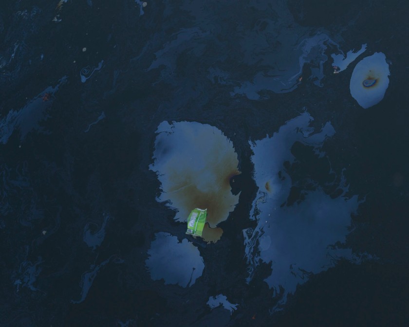
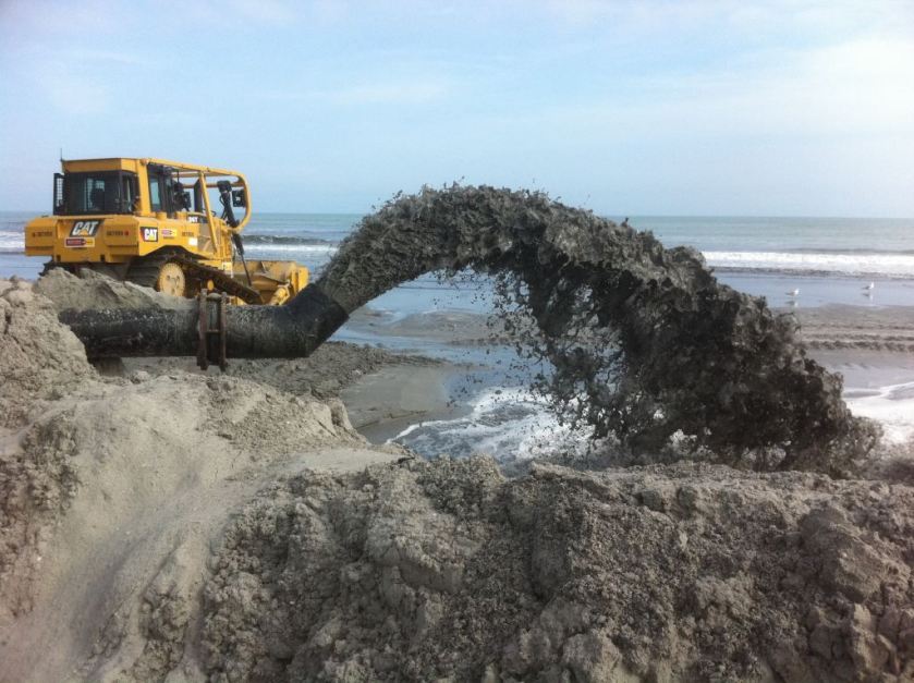
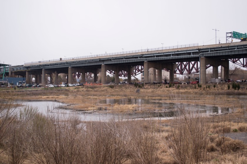
This image is from the Gowanus Canal in Brooklyn.
You can read more about me on the About Page or get in touch with me through the Contact Page. Thanks for checking out my blog!
When I go hiking, one of the first things I notice is whether an area has been taken over by invasive species. It detracts from my enjoyment of the experience because I understand how harmful they can be to an ecosystem. Invasive or nuisance species are usually non-native plants that spread and naturalize. They are able to out-compete with native species and can take over areas. Many invasive species began as ornamental plants because they are hardy and require little attention (EDD MapS 2016). In this blog I will focus on three invasive species that I saw in New York parks during my investigations: kudzu, porcelain berry, and phragmites.
Kudzu is a semi-woody, invasive vine that originated in China and Japan (Cornell University 2016a). It has beautiful purple flowers, which is what encouraged horticulturalists to begin growing it in the United States. It was then used as crop cover to prevent erosion and also as livestock feed. Now Kudzu is a prohibited and regulated invasive plant (Cornell University 2014) in New York. It is a nitrogen fixer, which means it can thrive in nutrient-poor soil, and is also drought tolerant. This combination made kudzu able to thrive in the US. Kudzu’s goal is to get as much sunlight as possible, so it climbs up trees and any other vertical structures, wrapping itself around it until it’s completely covered. Kudzu competes with trees for sunlight, nutrients, and water, but it also suffocates them. Sometimes the weight of kudzu vines leads to trees collapsing. It is rapidly growing and can out-compete native plants. This is very dangerous for wildlife as it can change the availability of food in their diet. There are enormous economic impacts from this fast-growing plant. Control of it can cost up to $200 per acre per year. It takes 5-10 year of focused eradication to get rid of a kudzu infestation and that means digging up their immense root structures and spraying herbicide.
Kudzu in Pelham Bay Park
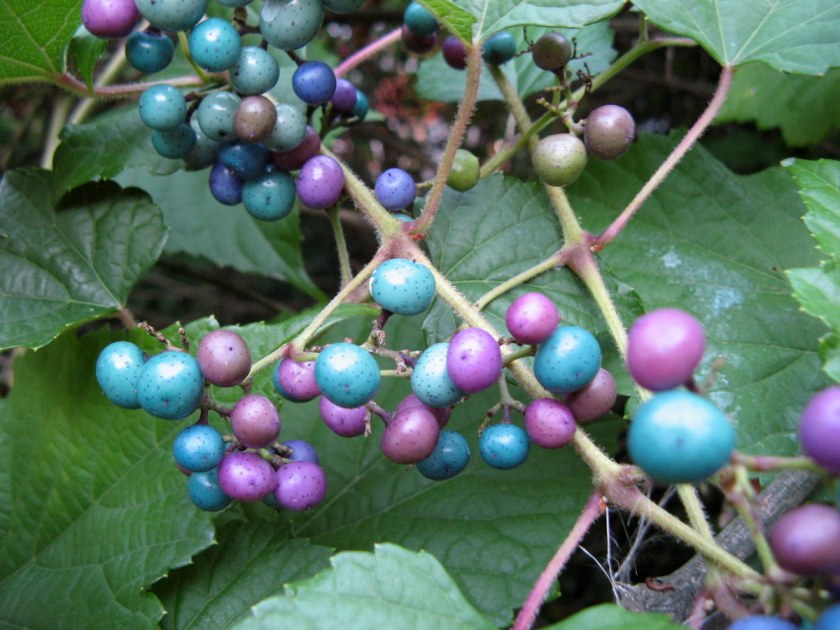
Like Kudzu, porcelain berry is a prohibited plant (Cornell University 2014), but only in certain states. It is not allowed in New York, but in other states it can still be used in landscaping and ornamentally. (Plant Conservation Alliance 2005). It originated in Northern Asia and is a type of grape vine with pretty berries, which is what drew so many horticulturists to use it. It spreads over open and wooded areas and grows over other plants, thus shading them out and taking over the habitat. A plant can grow up to 15 feet during one season. Porcelain berry is easily spread by birds and other animals who eat the berries, so it is important to get rid of the plant before flowering occurs. To remove it a combination of hand pulling and application of herbicides like triclopyr is recommended. It can take many years to fully eradicate a porcelain berry plant.
Porcelain berry – Source: Gardening Know How
Phragmites is a bit more complicated than other invasive plants. There are a three different types of phragmites and only one of them is non-native (Cornell University 2016b). The problem species is Phragmites australius, also known as common reed, which was brought in from ship ballast in the late 18th century. Non-native phragmites likes to grow near wetlands, but it will take over any open area. It is a nuisance because it can decrease the salinity of marshes, decrease the area of usable habitat for animals, and increase the chance of fire to an area. Control of phragmites populations is very important, though one has to be careful to only remove the non-native species. Goats can be used to consume the plant. Also fire has been proven to sometimes be effective, but it is unclear if it gets hot enough to kill the plant’s rhizomes – an underground stem, which phragmites uses to reproduce. Cutting the plant and applying herbicides can also help. It is important to immediately reseed the area with native competitors to prevent recolonization and erosion from occurring. Phragmites roots help stabilize the soil and once it is eradicated native plants are needed to strengthen it.
Phragmites in Freshkills Park
Though it may seem hard to control and prevent invasive species from taking over parks, it is vital to conserve these natural areas for the future. If you want to help get rid of invasive species, I recommend searching for a “friends of” or “conservancy” for your favorite local park and checking to see if they have any strikes against nuisance plants planned in the near future. The Natural Areas Conservancy would also be a great group to volunteer with to help protect New York City ecosystems. You can also look at volunteer vacation options with the American Hiking Society if you’d like to explore new areas while helping out a park.
Thank you for reading my blog. I have had a wonderful time exploring new parks across New York. I hope you learned something or felt encouraged to explore parks in your area. This will be my last post for a while, but I do plan to return with more entries about my explorations in the future.
It’s not impossible, but making your way to Freshkills Park is a bit of a trial. The park is not officially open yet, so one either has to visit during a planned event or get a group together for a tour. Despite the challenge, a trip to this amazing changing landscape is definitely worth the trek out to Staten Island.
Freshkills was originally opened in 1948 as a landfill. It was meant to be open for only three years, but it stayed open until 2001. A design competition was then held and a plan to create Freshkills Park was chosen. The company that won was Field Operations, the same group that designed the High Line. Work officially began on the park in 2010 and they hope to have it finished by 2030.
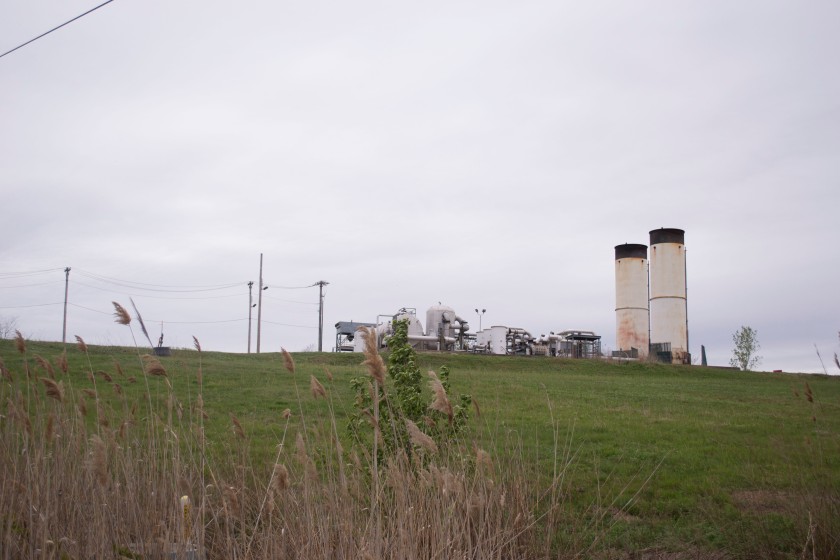
Smokestacks in the background of Freshkills
When I went on a tour of the park I was amazed that it used to be the world’s largest landfill. The rolling, grassy hills and the beautiful creek did not immediately scream trash mountain to me. Upon a closer look, I could see the signs of the past. Smoke stacks behind hills, garbage trucks, and gas well heads scattered throughout the landscape reminded me that the hill I was climbing was almost entirely made of trash. Between me and the trash was a soil barrier layer, a gas vent layer, an impermeable plastic liner, a drainage layer, at least two feet of barrier protection material, and at least six inches of planting soil. The engineers who designed this park had safety in mind when considering how to cover the trash. The drainage layer is to make sure that leachate (water that mixes with waste and toxic substances) would not leak into the kill (an old Dutch word for creek). The gas vent layer connects with the gas well heads and then the landfill gas (LFG, which consists of methane, carbon dioxide, water, and other organic matter) is then collected and stored. Since methane and CO2 are both greenhouse gasses, it is important that LFG is collected so they are not released into our already polluted atmosphere.
Freshkills, as well as reusing a damaged landscape and converting it into a natural area for the city to enjoy, also pays attention to how it can be environmentally sustainable. Currently the gas collected from the landfill is purified, sold to National Grid, and used to power many neighborhoods in Staten Island. In 2013 former New York City Mayor, Michael Bloomberg announced that Freshkills would be the site of the largest solar power installation in the city. This installation is expected to produce over 10 megawatts of power and make the city produce 50% more renewable energy. Wind turbines and geothermic heating and cooling systems might also be placed in Freshkills.
The reenergization of Freshkills also helps the city in other ways. The area was originally a low-lying salt marsh, but the landfill compacted everything and altered the landscape. The transformation of the landfill to a park has helped reestablish the marsh. The plan is to bring back native habitats and reduce non-native and invasive plants. Currently the park suffers from an infestation of non-native phragmites, a plant that looks like a tall grass and thrives near wetlands, but will take over any available lands. The park has used goats in the past to get rid of the invasive species, but the population of phragmites has come back. Anyway, the now reinvigorated marsh provides a vital service to Staten Island. During Hurricane Sandy, the hills of trash and waterways which were once used to float waste into the landfill, protected the neighborhoods of Travis, Bulls Head, New Springville, and Arden Heights from what could have been catastrophic flooding. Though they did still receive some of Sandy’s storm surge, they were saved from the worst of it.
Freshkills Landscape
Freshkills Park is a symbol of our changing mentality toward the environment and a hopeful sign to end my journey through New York’s parks this semester. Though only two sections of the park are currently open for all year public use – Schmul Park and Owl Hollow Soccer Fields – Freshkills Park will one day become the second largest park in New York City and be sustainable. It was designed with protecting our environment in mind and promoting green energy. I believe that the conservation practices currently in place at the park in combination with the sustainable design will make Freshkills Park one of the most prepared parks in New York for the effects of climate change.
Despite only walking a section of the Old Croton Aqueduct State Trail less than a mile long, I spent more than 4 hours on it one April morning. A group of over 200 volunteers gathered in Yonkers around a buffet of food to listen to the mayor and various other city officials talk about the importance of maintaining the trail. We could barely understand them over the murmurings of the crowd, though we did hear a shout out to Sarah Lawrence College, even though only three of us came to help with the cleanup. After the men and women in suits finished speaking, the rest of us took to the trail and the Annual Yonkers Cleanup Day really began. We were all ready to get started on what we were actually there for – making the section of the OCA in Yonkers a more pleasant space.
Dumping problems paralyzes this section of the trail, which spans from Palisade Ave to Prescott St. The trail is seen as a convenient area to get rid of bulky items, such as mattress or reclining chairs. During our cleanup I saw at least two of each, as well as many other interesting items. The biggest problem was the amount of litter – bottles, cigarettes, Styrofoam, plastic plates. With no garbage cans along the pathway, people think that they can just throw their trash anywhere. The worst items were the plastic bags. They were partially decomposed and tore into tiny pieces as we tried to pick them up.
Trash is not the only problem the trail has though, the trees are covered in invasive vines. Like in a lot of the parks I’ve visited in New York, many of the trees have been completely taken over by vines. The Friends of the Old Croton Aqueduct have two events planned in the near future, one at the section of the trail in Croton-on-Hudson and the other with a location unspecified, which will focus on weeding out invasive species on the trail. They also encourage people who wish to volunteer to specifically focus on trail cleanup and invasives removal.
Unlike most of the parks I have visited during this project, the trail is not directly on the water. That means that while thinking about how the trail will fare against climate change, rising sea levels are not an important concern. What is a concern is getting rid of invasive species and preventing dumping and littering.
This slideshow requires JavaScript.
If the trash in the park continues to be mismanaged that could lead to it getting into the waterways and hurting the marine animals. Cigarette butts, which are prevalent on the trail, are considered toxic waste. They do not biodegrade – the plastic in the filters just breaks down into smaller pieces. The toxins from cigarettes also leach into the water and can kill wildlife. In addition, the park has other waste, like needles, which can become hazards to unsuspecting people whom simply want to enjoy the park. To prevent more damage from occurring on the trail and lessen the effects of climate change, I would encourage the placement of trashcans along the trail. It might also be helpful if the Yonkers Clean Up event occurred more frequently than just once a year.
As I have shown in my earlier science posts, sea level rise is one of the biggest challenges New York City will face due to climate change. The storm surge of Hurricane Sandy made it clear that the city was not equipped against floods caused by extreme weather events. In earlier posts two options were explained, a “soft” approach – beach nourishment – and a “hard” approach – barriers. In this post we will discuss retreat, the option left when nothing else will work.
Retreat is the act of moving away from the shoreline. Residents are encouraged to sell their land and then the government allows the land to return to its natural state. The option was discussed in Gornitz et al.’s 2002 paper Impacts of Climate Change on NYC Coasts. In Storm Surge, Sobel mentions a similar plan in the Netherlands. “Return to the River” forced residents, who were mostly farmers, to leave an area, which was then returned to a floodplain. A few negotiated to stay in the area, but the majority left.
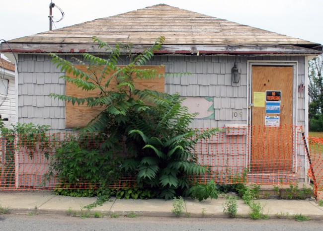
After Hurricane Sandy, it became even clearer that retreat would be necessary. While Bloomberg said that retreat was not an option (Revkin 2013), Governor Cuomo signed off on the purchase of three neighborhoods in Staten Island, Oakwood Beach, Ocean Breeze, and Graham Beach, for retreat as part of the Hazard Mitigation Grant Program. These neighborhoods had almost all of the residents agreeing to sell their homes, with a few holdouts (Rush 2015a). During his State of the State address, Cuomo said, “There are some parcels that Mother Nature owns […] She may only visit once every few years, but she owns the parcel and when she comes to visit, she visits” (Homeland Security News Wire 2013). Many other neighborhoods along the east coast of the island, all of which were hit very hard by the storm surge of Hurricane Sandy, wanted to get in on the buyout, but a representative of Cuomo said the governor would not authorize the purchase of the entirety of the coast. The purchased neighborhoods have already begun to be demolished and reestablished as wetlands. The land would be planted with native grasses and retention pools would be built to capture the rainwater. The process cannot be completed until all residents leave. A large section of one neighborhood is currently owned by a developer who is holding out on selling the land, which poses a problem for the reestablishment (Rush 2015b).
A home in Oakwood Beach waiting to be demolished – Source Urban Omnibus
There are other options for homeowners who want to relocate. “Build It Back” is a program which offers to pay for repairs or elevation of homes hurt by Hurricane Sandy. An acquisition program run alongside “Build It Back” offers to purchase homes on their own instead of a neighborhood buyout. The difference between this type of purchase and a group buyout is that individual purchases do not get returned to nature, instead they are redeveloped and new structures are built. This is not as good of a plan as retreat. Most of the areas that become severely flooded during storms used to be wetlands and were backfilled to make room for buildings. More than half the people who died during Hurricane Sandy lived in areas that used to be wetlands (Rush 2015a). Rebuilding on these areas could increase the number of fatalities in the future.
Retreat, though the severest choice in the fight for the coast, is the safest option both for human life and wildlife. Beach nourishment and barriers both lead to erosion and damage the habitat of wildlife that lives in the area. They are also incredibly costly and though barriers can reduce flood levels, they still leave residents in danger from the water that makes it over the seawall. Retreat puts no one in danger and returns the land to its natural state. Wetlands will protect the coast from sea level rise and storm surges. They will serve as a buffer for nearby residents from the elements and also vice versa by stopping runoff from going directly into the ocean.
In the next, and final, science blog we will take a look at some of the invasive species I got to know during my visits to New York parks.
Bibliography:
Gornitz, V., S. Couch, and E. K. Hartig. 2002. Impact of sea level rise in the New York City metropolitan area. Global and Planetary Changes 32: 61-88.
Sobel, A. 2014. Storm Surge: Hurricane Sandy, Our Changing Climate, and Extreme Weather of the Past and Future. HarperCollins. New York, New York, USA.
Before beginning this post I want to make it clear that I spent all of ten minutes in this park. I had heard about the park from a friend and, while on a hiking trip the first weekend in April, I finished hiking early and was able to drive over to the park with the extra time before I had to return my rental car. I was able to look around and get some pictures of the New Croton Dam, but I did not get a chance to hike on the trail.
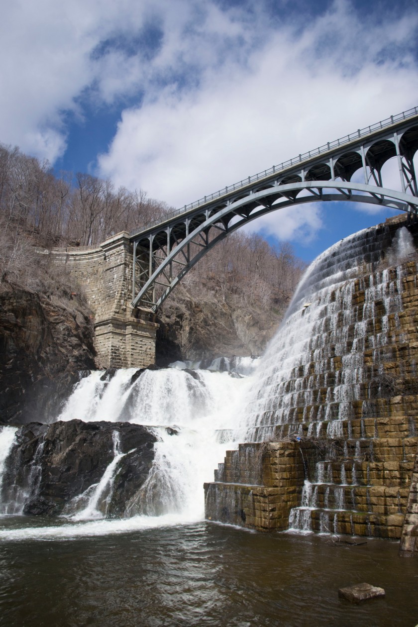
The dam is 200 feet tall and was the first large-scale masonry dam in the US. It was built from 1892-1906 and was originally meant to bring drinking water to New York City, but the needs of NYC soon outgrew the capacity of the dam. To create the dam, the riverbed had to be diverted and dried, then a canal was built to alter the flow of the river. While on top of the dam, one can see the Croton Reservoir, which can hold 34 billion gallons of water. There are many fish in the reservoir, including bass and perch species. Rowboats are allowed on it, but must first be approved by the NY Department of Environmental Protection.
New Croton Dam
When you drive into the park, you immediately get a view of the dam. It’s beautiful with the water cascading off the stones, before flowing under the bridge. On the day I visited, the view was marred slightly by a fenced off spot next to the side of the dam. Across the bridge, there is a wide, open space with plenty of picnic tables, a playground, a baseball field, and bathrooms.
On one side of the field, after flowing off the dam, is the river, which is open for fishing, but not for swimming. Though in many places in the Hudson Valley it is not recommended to eat more than one fish meal per month for men over fifteen and women over 50 due to mercury contamination, the NY Health Department does say it is okay to eat up to four fish meals per month for people of all ages from the New Croton Reservoir as of 2014. It is not safe enough to swim in, though that might have more to do with the river than the water quality.
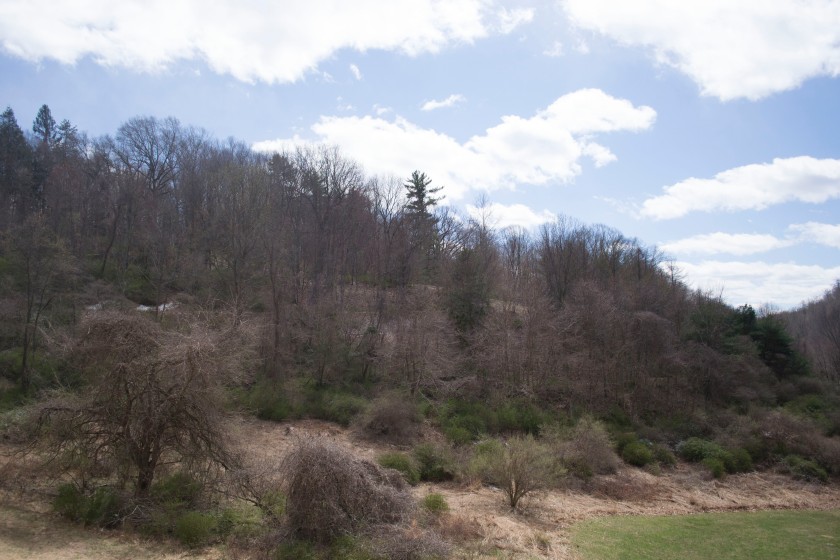
The wood in Croton Gorge Park
On the other side of the field there is a wood. Like most of the woods I’ve visited in New York, it was covered in vines. The one trail in the park leads up through the woods to the top of the dam and also connects to the beginning of the Old Croton Aqueduct Trail (stay tuned for a post about that trail), which stretches 26.2 miles to Van Cortland Park in the Bronx. The trail is the only way to reach the top of the dam. There is a road that crosses over the top, but cars have been prohibited to cross it since 9/11. If someone is in a hurry to see the top of the dam, they can park on the side of the road before the blockade and cross on foot, though signs are posted that say parking is not allowed.
Back in the main part of the park there is a fountain, which sometimes is operational. I unfortunately didn’t get to see it working, but, when it is active, the pressure of the water in the reservoir powers it. Other than the invasive vines and some trash overflowing from the bins, the park appears to be well kept. Though this park might not be impacted by rising sea levels, the dam has large environmental impacts, which must be acknowledged. Dams prevent the migration of fish and altering riverbeds diminishes areas where fish can spawn in river bottoms. Another impact is that sediment is trapped by the dam, which can lead to the river being eroded further downstream. This park may be enjoyable and the dam a pretty photographic opportunity, but it is not without its environmental consequences.
Beaches are an important form of recreation, especially in the summer, but, because of climate change, they are in danger. Rising sea levels as well as the increased potential of dangerous storms exacerbate beachfront erosion. More than 70% of the world’s beaches are experiencing losses due to erosion (Bird 1985). One method of fixing this problem is beach nourishment. Though there are benefits to this solution, there are also large costs, both environmentally and financially.
Beach nourishment, or replenishment, is the act of removing sand from offshore sand bars located close to the beach and replenishing the beach with this sand. This is ideal because the sand is usually a close match to the grain size of the original sand. (Gornitz et. al 2002) If it is not a perfect match it will alter the sand composition of the beach, which can upset some beach goers. Beach nourishment is considered to be a soft approach because it is only a temporary fix to the large problem of erosion. It needs to be repeated often so as to continue the effect. This soft approach is preferred over hard approaches, such as the building of groins or sea walls, because those structures often cause increases in erosion down drift. Replenishment benefits communities because beaches increase tourism and, if located in residential areas, usually increase property values. In some cases, individuals are willing to pay for beach replenishment. Beaches also help to protect coastal areas from storms – they prevent sediment overwash and stop salt water from inundating coastal wetlands (ASBPA 2007).
Sand being moved to replenish a beach – Source: Sea Turtle Camp
Many New York City beaches have undergone beach nourishment. After the damaging effect of Hurricane Sandy, Rockaway Beach has had 3.7 million cubic yards of sand moved to restore its beach. In addition, Coney Island, the East and South Shore of Staten Island, and Orchard Beach in the Bronx were locations of beach nourishment. Hurricane Sandy also greatly damaged other beaches. In three waterfronts of NYC (New York Harbor, Raritan Bay, and Jamaica Bay) 25% of beaches and 28% of beaches along the Long Island Sound lost between 50 and 100 feet of sand due to the effects of erosion (Anderson 2013). With chances of severe storms increasing because of climate change, according to the IPCC Summary for Policy Makers (2013), one must expect that beach nourishment will be increasingly necessary if New York wants to retain current beach levels.
Moving that much sand has a cost. Gornitz, et. al (2002) states that over half a million dollars has been spent in New York state alone on beach replenishment. Rockaway Beach’s restoration project, which included reconstruction of the boardwalk, construction of baffle walls, and sand retaining walls, as well as beach nourishment, cost more than $140 million dollars. Before that $216 million had been spent to replenish Rockaway’s beaches (Nessen 2013). From 1923-1995, $25 million dollars was spent on beach nourishment for Coney Island. These costs will only increase in the future as more sand will be needed for replenishment and the sand closest to the beach will be depleted. In addition, sand added through beach nourishment erodes two to three times faster than natural beaches (Barber n.d.). This will add to the amount of nourishment needed.
As well as these financial effects, beach nourishment negatively affects the environment. The moving of sand can make the water too muddy, bulldozers can squish species that reside on the beach, or change the shape of the beach to such a level that it makes it impossible for certain species to reside there. After Hurricane Sandy, even though beaches were heavily eroded, there are possible positive effects for animals. The flattening of beaches in Breezy Point, the Rockaways, and Fire Island could enable the piping plover, which is endangered, to nest in new places (Anderson 2013). The changes on the beach caused by erosion or storms are natural and beneficial to animals that make their habitat on the shore, while human caused beach nourishment can make life difficult of species like sea turtles who lay eggs on beaches.
Beach nourishment is a complicated matter. While it helps protect coastal areas and allows for recreational use of beaches, it can also destroy ecosystems and be financially costly. In the fight to conserve recreational spaces in the face of climate change, we much decide whether protecting our beaches is worth the cost it carries.
Bird, E.C.F., C. Wiley. 1985. Coastline Changes: A Global Review. 219 pp. New York, New York, USA.
Gornitz, V., S. Couch, and E. K. Hartig. 2002. Impact of sea level rise in the New York City metropolitan area. Global and Planetary Changes 32: 61-88.
IPCC, 2013: Summary for Policymakers. In: Climate Change 2013: The Physical Science Basis. Contribution of Working Group I to the Fifth Assessment Report of the Intergovernmental Panel on Climate Change [Stocker, T.F., D. Qin, G.-K. Plattner, M. Tignor, S. K. Allen, J. Boschung, A. Nauels, Y. Xia, V. Bex and P.M. Midgley (eds.)]. Cambridge University Press, Cambridge, United Kingdom and New York, NY, USA.
Riverside Park, located next to the Hudson River and stretching 4 miles, is a beautiful park though the day I was there it was raining. It wasn’t as enjoyable as it could have been. The park is a bit unusual seeing as the West Side Highway splits it into two parts. On one side is the forest, with lots of paths and fields for sports. The other side has a trail that runs along the Hudson. I got a chance to explore both of them.
The park has lots of diverse elements to it, which attract lots of different people. There are many sports areas including those for basketball, soccer, baseball, tennis, and skateboarding. The park has a large marina and during the spring and summer one can rent kayaks. There is a play area for children and many historical monuments. One interesting monument is actually a part of the National Parks System. Grant’s Tomb is a beautiful memorial and historically important.
An interesting section of the park is the Woodland Restoration area. First, I want to point out a bit of confusion. In the park there was a sign that said “Forever Wild”. This is a program from the NYC Parks system to protect and preserve ecosystems in the city. Though on the map of Forever Wild areas Riverside Park is included, it is not listed as a location of the initiative in other sections of the website. Whether or not the restoration done in Riverside Park is a part of Forever Wild project, the work done is very important. The original trees planted in this area had grown very tall and formed a lush canopy. Underneath this canopy, non-native plants had spread and taken over the landscape. Volunteers have started to remove invasive trees, put down compost, and created a berm – a strip of land bordering a river – that has an erosion cloth, to slow runoff. Native grasses and perennials were then planted. Finally, the canopy has been pruned to allow for more sunlight to reach the newly planted flora.
Woodland Restoration in Riverside Park
There are limited access points to the trail, called Cherry Walk, but it is definitely worth taking a walk along. Be careful though – I was strolling along the path and paused for a second and got yelled at by one of the bikers. The trail is located right next to the Hudson River, with hardly any space between the path and the water. One part of the trail does have a fence protecting it from the riverbank, but on other parts you can step off the trail and put your feet in the water. (Though swimming in the Hudson is legal, I would not dare to do that, at least not in the weather that I experienced while walking along the trail.) On the other side of the trail is the West Side Highway. With how close the trail is to the river, I expect that many parts of the trail would be vulnerable to sea level rise. The rest of the park would be protected from any changes in sea level because it was built on top of retaining walls. Still any change to the park would be a great loss to the city since the park is one of eight scenic landmarks in NYC, according to the NYC Parks Department.
Easy access to the Hudson River
While I was walking along the trail I saw an interesting sign. I just glanced at it, but as far as I could tell it was asking for money to build new bathrooms. When I investigated online I found out it was a part of the Green Outlook (GO) initiative, which wants to build a rest area alongside the red clay tennis courts in an abandoned parking lot. This facility would be a sustainable maintenance building, and would include a wildflower meadow on the roof and a carbon-neutral public restroom which would have composting toilets, use solar energy, rainwater, and recycled materials. The compost would be used to fertilize the meadow. I think this initiative is great. Creating sustainable buildings makes people think about climate change during times when they usually wouldn’t. The building is also a great example of how other urban buildings, outside of parks, can be sustainably designed.
Randall’s Island is a park in sections. I visited the island on a rainy morning in April. I was surprised, upon entering the park, to see how much of it was not actually parklands. The island has a wastewater treatment plant, a fire academy, a psychiatric center, a shelter, and a few other buildings. Along the edges there are gardens and wetlands, and on the inside are soccer fields, tennis courts, a stadium, baseball diamonds, and a golf course.
I walked along the southern edge of the island. The path is multi-purpose allowing for both walkers and cyclers to use it. It’s edged with pretty gardens, including one section that is a native plant garden. This is a great conservational move because native plants need less maintenance than non-native plants and do not promote the spreading of invasive species. This does make me wish that all of the gardens on the island used native plants.
Marshlands at Randall’s Island
Just a few feet from the path is the East River. There are no protections to stop the river from flooding the island in the event of a storm, but the grass strip between the path and the river does help prevent runoff from entering into the water. The northern end of the island, which I didn’t have a chance to explore, has even more protective elements. That section of the park is home to salt marshes and freshwater wetlands. Both of these natural areas work as barriers between the developed sections of the park and the river during floods or storm surges by soaking up the excess water and releasing it slowly. They also help to stop erosion and offer food and sanctuary for birds.
Just a step and you’re in the East River.
The Randall’s Island Park Alliance has raised over $16 million to restore and develop the natural areas of the park. They first worked on restoring the salt marsh and freshwater wetland; later they repaired a seawall, planted another salt marsh and helped create a second growth forest.
Another cool feature of the island is the Urban Farm. Only an acre large, the farm produces organic fruits and vegetables and uses a wide variety of growing methods. Some food found at the farm includes: rice, kale, leek, broccoli, lettuce, carrots, and corn. There’s also a chicken coop. Even a farm as small as this one is great in this changing ecological world. An urban farm helps, in a small way, reduce the city’s ecological footprint.
Though the majority of Randall’s Island is likely to be flooded in the case of an extreme weather event and rising tides would severely decrease the acreage of the island, I believe Randall’s Island is doing its best to fight the effects of climate change. They regularly look for volunteers to help get rid of invasive plant species, plant native trees, and get rid of trash. The restoration of coastal marshes goes a long way to helping prevent runoff and erosion from hurting both the park and the river.
From an island in the East River to a park alongside the Hudson, in the next post I cross Manhattan to visit Riverside Park.
With the threat of rising sea levels, the New York City government has to seriously consider how to protect its land. New York is not only threatened by elevation of the water level, which could decrease the size of coastal areas, but also by the increasing damage that could be caused by storm surges. One way that the coast could be protected is by building barriers.
Examples of barriers include seawalls, groins, and jetties. Seawalls are exactly what they sound like, walls built in the sea, which protect the coast from being inundated with too much water (Gornitz et al. 2002). Groins are a series of posts or sometimes a wall, built onto a beach that is meant to catch littoral sand that is moved by the currents. Jetties are long strips of land that make inlets stable and protect harbors from the worst effects of waves. The decision of where to place barriers and what kind of barrier to use is vitally important, both to the area it protects and the ecosystem it affects.
After the disastrous effects of Hurricane Sandy, New York City had to consider what can be done to protect itself. One option that was first thought of was to build moveable barriers in the ocean, like those found in the Netherlands. (Sobel 2014) There are examples of barriers like that as close as New England, protecting small channels from being flooded with water. But those types of barriers only work for small areas. The shores of New York are too long to be protected by a moveable barrier. Bryan Walsh wrote in Time that a Dutch-style barrier surrounding New York City from Sandy Hook, New Jersey to Rockaway Beach would be an option, but would cost anywhere around $10 – $15 million (Walsh 2012). Christa Marshall in Scientific American wrote about a proposal to build two different seawalls, first a seawall in the East River, then a seawall from Sandy Hook to Rockaway Beach (Marshall 2014). This double seawall would create an extra layer of protection. It is doubtful that this will completely stop all flooding, but it would limit the amount of damages that would occur in New York. Still, though barriers are able to stop water from damaging the land, they also have great consequences.
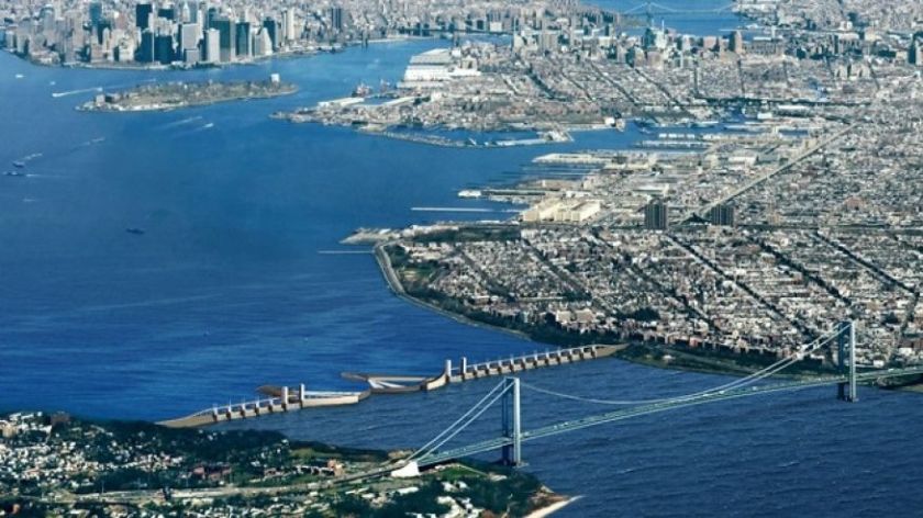
A rendering of a sea wall between Brooklyn and Staten Island – Source Fox News
The greatest consequence of coastal barriers is erosion. With seawalls, erosion occurs both at the base of the seawall (Gornitz et al. 2002) and further down the coast where the seawall does not extend. These areas suffer even more than they usually would because the seawalls just move the waves further along and when they reach an unprotected area, the waves are even more powerful than normal (Dunn 2009). If rubble is placed directly next to the seawall, erosion at the base can be decreased. Groins, if they are not placed in the right spot usually increase erosion of beaches further downstream, as do jetties. Erosion of beaches causes habitat loss for animals who nest or lay eggs there and can decrease the number of invertebrate species who live on the beach (Dugan and Hubbard 2010).
New York must consider the cost of building barriers. Though they might protect the city from flooding, they could also pass the consequences further along to other cities. Building barriers is considered to be a “hard” approach. In the next science post, I will investigate a “soft” approach, beach nourishment.
Bibliography:
Dugan, J.E., and D. M. Hubbard. 2010. Ecological Effects of Coastal Armoring: A Summary of Recent Results for Exposed Sandy Beaches in Southern California. US Geological Survey, Department of Interior. Scientific investigations report, 2010-5254. Reston, VA, USA.
Gornitz, V., S. Couch, and E. K. Hartig. 2002. Impact of sea level rise in the New York City metropolitan area. Global and Planetary Changes 32: 61-88.
Sobel, A. 2014. Storm Surge: Hurricane Sandy, Our Changing Climate, and Extreme Weather of the Past and Future. HarperCollins. New York, New York, USA.
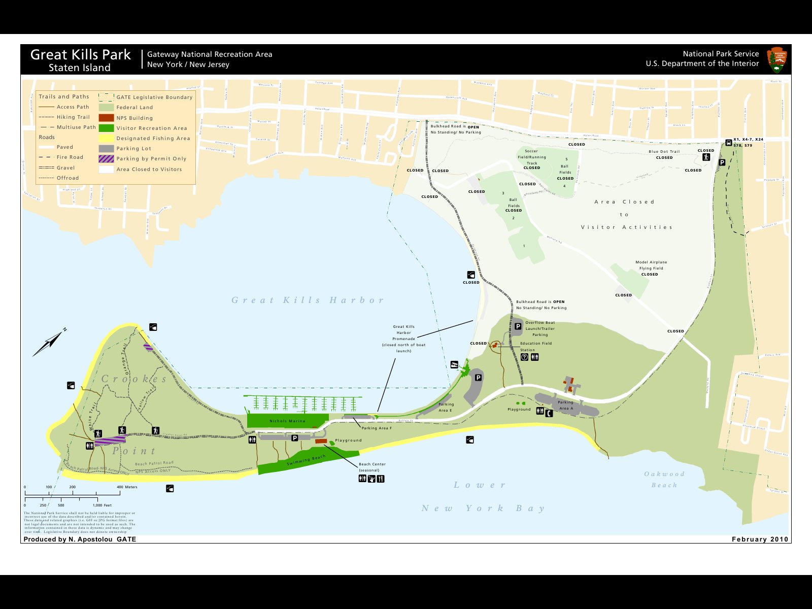
My trip to Great Kills Park, part of the Staten Island Unit of Gateway National Recreation Area accidentally occurred too early for two different reasons. The first reason is that I went in late March, only a week before the ranger station opens up for the summer season, though I didn’t realize it at the time. The second reason takes a bit more explaining, so keep reading.
After a long bus ride from Manhattan, I arrived at Great Kills Park – two stops after the one I was supposed to get off on. Siri has never been my friend and the location I thought was supposed to be the park entrance was actually just a fenced off section of the park. I walked along the side of the road to get back to where the gate is and once again took in the sight I’ve become so used to: trash everywhere and lots of vines.
When I finally made it to the gate I was surprised to realize how far of a walk it was to get to the main section of the park. The sidewalk stretched on forever and there wasn’t much to see. The parklands on either side of the road were fenced off. I saw a sign saying that an environmental cleanup operation was going on and that entrance was prohibited. Other signs said that there were hazardous materials in these spaces. I kept walking.
The path was surprisingly busy, despite the chill. Lots of people were running or riding their bikes. Some walked with family, others chatted on their cell phones. All were out to enjoy the park.
Eventually I reached the beach, and the closed visitors center and parking lots. The beach seemed nice, though lifeguards were not posted at the time (they’ll start working after Memorial Day). I’m not much of a beach person, so I kept walking. I passed by the busy marina and walked all the way out to Crookes Point. In this area of the park I was finally able to find hiking trails, though they were very short and not cleared very well. They felt like afterthoughts to the general purpose of the park. Finally, I sat on the edge of the water, on a rocky ledge, watching a group of men fish and some seagulls fighting.
All in all, I have to say that this is not my kind of park. I prefer parks with great views and lots of hiking trails. Great Kills is meant for more recreationally minded people, what with the beach and marina. My assessment of the park was furthered when I was able to get ahold of a map. The park contains soccer fields, four ball fields, a model airplane flying field, and a few more trails in that mysterious closed off section of the park.
That 265-acre mystery section was once a city landfill. Robert Moses (the same Moses who built the Jamaica Bay Ponds) wanted to strengthen that section of Staten Island marshland so that it could be used for recreational purposes. Household and industrial trash was dumped there to compact the land and fill it. In 2005 during a helicopter sweep of the area, the New York Police found 80 hot spots of radiation, which were 200 times the background levels expected in such an area. That section of the park was then closed down to be surveyed. Though Hurricane Sandy delayed the survey process, eventually the National Parks Service discovered 1,200 locations with elevated levels of radiation. Thirty-five of the spots were excavated and the rest still need to be investigated.
It doesn’t end there though. During the survey, the NPS realized that not only was the radiation even more prevalent than they first suspected, they also found out that the waste material dumped in the land, as well as having radioactive materials, contained chemical contaminants. This has led to another, separate study of the land that started in 2015, which will take approximately five years to finish.
Trash on Crookes Point in Great Kills Park
It’s hard for me to make an assessment of how well Great Kills can stand up against climate change with so much of the park blocked off. It was difficult to get a feel for how much land invasive species had taken over. From what I could tell, the beach seemed healthy – if a bit full of trash – and there were barriers in place to prevent erosion. On park message boards I saw signs for a Littoral Society clean up event from last October. I visited Great Kills four years too early to really understand the park, but hopefully I’ll get the chance to visit again in the future.


